School project · Geospatial analysis · 2026
Idaho Mental Health Access Map
An interactive map that compares Idaho mental-health facilities with estimated travel time and visible source data.
- Role
- Project creator
- Timeline
- 2026
- Stack
- React · Leaflet · Turf.js · GeoJSON · OpenStreetMap · Vite
- Project at a glance
- 31 verified facilities · 4 facility types · 7 cited source groups
 View full image
 Overview
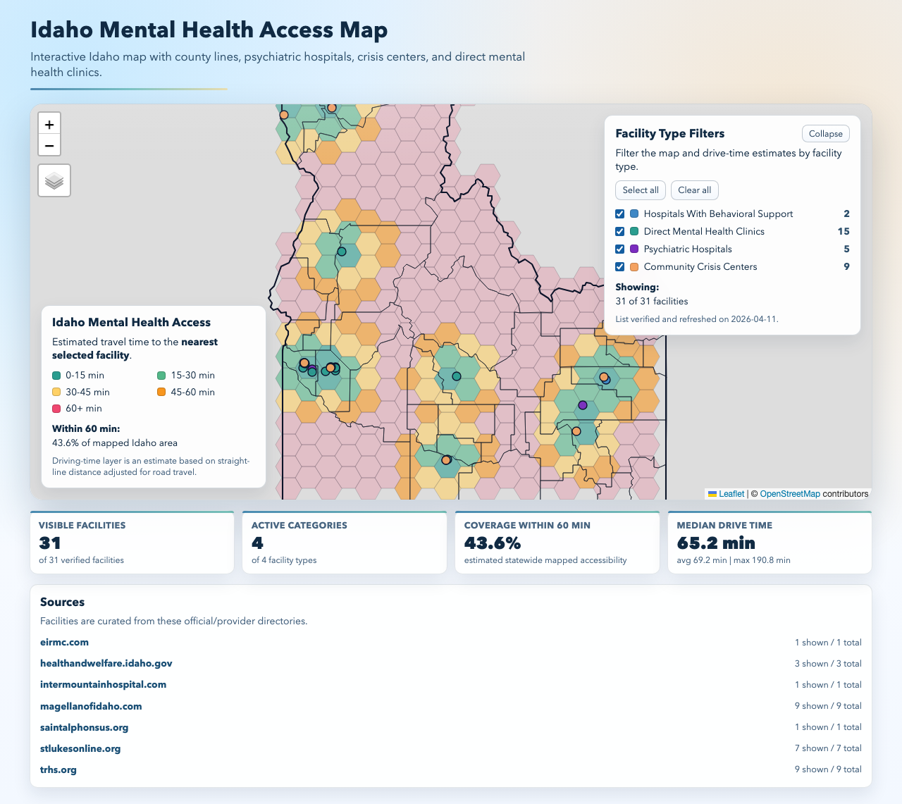
The map combines verified facility records, Idaho county boundaries, and a statewide travel-time surface so users can compare where care exists and where access may be thin.
Official and provider directories list facilities one at a time, but they do not show the statewide pattern. That makes it hard to compare facility types or see which areas may face longer trips.
How it works
Follow the data from input to interface.
- Facilities
Curate facility records from official and provider sources across four care types.
- Geo analysis
Use a hex grid and nearest-facility distance to estimate travel time.
- Access map
Update the map and summaries as filters change, with sources and limits in view.
What I built
Curated 31 psychiatric hospitals, crisis centers, direct mental-health clinics, and hospitals with behavioral support, with source and verification details for each record.
Built the React and Leaflet map with county boundaries, facility filters, layer controls, tooltips, source links, and responsive layouts.
Used Turf.js to generate a 10-mile hex grid, find the nearest selected facility, and calculate the coverage, median, average, and maximum travel estimates shown in the interface.
Key choices
Kept facility filters and the travel-time surface in sync so each comparison reflects only the selected types of care.
Estimated driving time from straight-line distance with a documented road factor and average speed, then labeled the result as an estimate throughout the interface.
Linked every facility group to an official or provider source and exposed the active and total record counts instead of hiding the data behind the map.
Outcomes
Turns 31 separate facility records into one statewide view with four care categories and county-level context.
Shows the share of mapped Idaho within an estimated hour of care and reports median, average, and maximum travel estimates for the active filter set.
Makes the method, sources, verification date, and key limits visible alongside the result.